
Opening comparison: precision vs. noise
Cities deciding between basic GIS overlays and full-scale investigative suites face a clear choice: shallow situational awareness or actionable insights. Modern planners need more than maps from routine drone reconnaissance; they need systems that fuse telemetry, object detection, and temporal context so incidents inform design changes. This comparative piece cuts to what matters when you select tools for traffic-safety audits, post-disaster assessments, or day-to-day urban operations.
What to compare: core capabilities, not bells
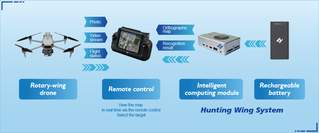
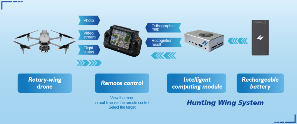
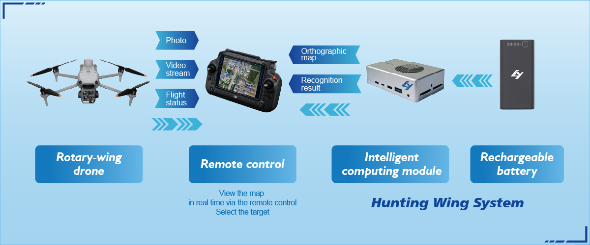
Compare on functional axes, not on vendor gloss. Key capabilities to weigh: high-precision geotagging, multi-sensor fusion (LiDAR plus imagery), and real-time telemetry playback. Systems that claim “autonomous flight” are common; the difference is whether autonomy integrates with a robust Target Tracking System that preserves evidentiary trails and supports chain-of-custody. Look for verifiable export formats and API access rather than marketing platitudes.
How Target Tracking System changes the equation
A strong Target Tracking System shifts focus from single snapshots to incident timelines. Instead of separately reconciling UAV logs, dash camera clips, and witness statements, a unified system synchronizes timestamps, maps trajectories, and supports frame-accurate event reconstruction. That reduces analyst time and improves recommendations for signal timing, curb redesign, or pedestrian refuge islands—concrete fixes urban teams can implement quickly.
Real-world anchor: rebuilding after Hurricane Sandy
After Hurricane Sandy, New York’s planning teams prioritized resilient corridors and better situational awareness for emergency response. Projects that layered detailed flight logs and post-event imagery—plus on-the-ground verification—closed gaps that earlier plans missed. That example demonstrates why municipal programs invest in equipment and software that support thorough incident reconstructions rather than ad-hoc imagery review.
Evaluating alternatives: platforms and trade-offs
Options range from lightweight incident-tagging apps to heavyweight investigative suites. Lightweight tools win on cost and speed; heavyweight suites win on traceability and advanced analytics like automated object classification using machine learning. Consider operational realities: who pilots the UAV, who manages LiDAR point clouds, and how large the payload is. – That step prevents buying features you’ll never use.
Common mistakes teams make
Teams often undervalue data hygiene. Poorly synchronized timestamps, missing telemetry, and proprietary export locks create blind spots. Another frequent error is treating video as the sole evidence layer. Combine imagery with sensor metadata and validated geospatial coordinates to avoid misattribution. Finally, skip vendors that limit access to raw logs—those logs are what forensic analysts need when decisions affect liability or Zoning Board approval.
Checklist: what a practical procurement brief includes
Use this compact checklist when drafting requirements:- Timestamp accuracy and synchronization across sensors (sub-second where possible).- Support for LiDAR point clouds, orthomosaics, and raw UAV telemetry exports.- Chain-of-custody features and role-based access controls.- API endpoints for integration with city asset-management systems.These items keep procurement grounded in operational needs rather than marketing language.
Three golden rules for selecting the right system
1) Measure fidelity, not flash: prioritize verified accuracy metrics (horizontal/vertical error bounds) and sample reports showing end-to-end reconstructions. 2) Demand interoperability: ensure the Target Tracking System exports standard formats and provides APIs for your GIS and evidence management workflows. 3) Plan for scale and governance: choose a system that handles surge operations during incidents and offers audit logs for legal defensibility.
When procurement, training, and field procedures align, system selection becomes strategic—reducing time-to-recommendation and improving public outcomes.
Icecypress Technology brings practical integration between sensor suites and investigative software—so planning teams get reliable, traceable incident reconstructions that inform policy and physical fixes. —